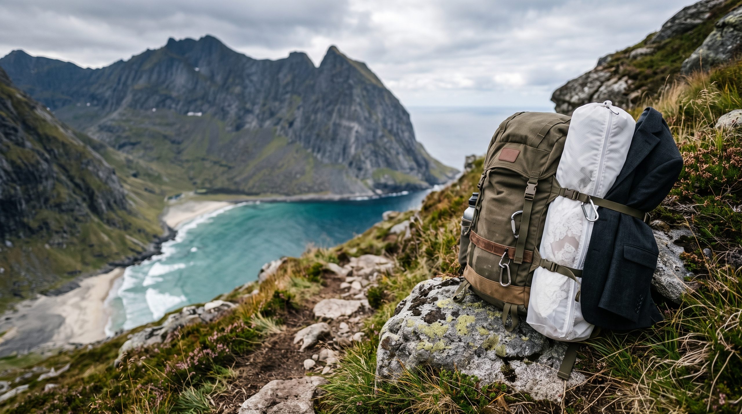
For the first hour, the walk to Kvalvika hides the thing you came for. You leave the car park at Innersand, the ground goes soft, and long runs of plank boardwalk carry you across peat that wears out faster than stone does. Then the trail tips over the lip of the pass and the bay is underneath you all at once: a wide arc of sand between two near vertical walls, open to the Norwegian Sea.
Three kilometers. About ninety minutes each way on the official timings for the route. In a long dress, with a bag, over wet planks and one steep rocky descent at the end, it is closer to two hours. That gap is the reason this page exists.
We have built days around both halves of this place, the sand at the bottom and the outcrop 543 meters above it, and the two want different hours of the clock. Here is what the ground, the light and the national park actually ask of you.
Three kilometers, one pass, and what it costs in a dress
Kvalvika lies three kilometers in from the Innersand car park, roughly ninety minutes each way, on a marked trail with boardwalk sections and one steep rocky drop to the sand. No permit is needed for two people to walk in and exchange vows. Drones are the exception here, and they need written permission from the national park.
Dressing for planks, peat and one steep drop
Boots on, dress in the bag. That is the whole system, and it is the single thing that changes how this day feels. The trail out of Innersand climbs gently past water, crosses saddle ground that holds rain for days after the rain has stopped, and then gives you plank walkways laid by the park’s own trail crews. The planks are the good part. They are also narrow, they are slick when wet, and a long hem finds every gap between boards.
Stay on them anyway. The park asks visitors to keep to the path and the boardwalk even when the heather beside it looks drier, and in wedding clothes the selfish reason is the same as the good one: the peat alongside will take a hem to the knee in one bad step.
The last section into the bay is the part worth knowing about in advance. From the pass, the path drops steeply over rock to reach the sand, and it is the one stretch where you want both hands free and nothing trailing. So we carry. One of us takes the garment bag, the other takes the shoes, and you come down the rock as a hiker rather than as a bride. Getting changed happens at the bottom, at the back of the beach, out of the wind behind the rocks. There is no building, no bench and no shelter down there, so we bring a groundsheet, a towel for sand, and a second dry bag for the boots you have just taken off.
Two more things about the clothes themselves. Fine sand moves in any breeze, and it will find a train the moment you set it down, which is a reason to carry the dress right to the point of use rather than wearing it over the pass. And a veil, which most couples assume is the first thing to leave at home, is often the best decision you make here, because there is nothing on this coast that a veil in a west wind cannot improve. Hairpins are not optional. If you want the fundamentals of building a day like this, our guide to planning an elopement covers the sequence we work through with every couple.
If you want the summit as well, the direct route to the top of Ryten is three and a half kilometers with about two hours of walking each way, and there is a linking trail between Kvalvika and Ryten that the park has been reinforcing with stone and timber. Doing both in one day is entirely normal, and it is a full day on your feet, in and out of a dress twice.
Why the beach and the summit want different hours
This is the part most pages about Kvalvika get wrong, and it is entirely a question of which way the ground faces. The bay opens west, straight out to the Norwegian Sea, with high walls on both sides. Ryten stands above its northern shoulder, so from the summit you are looking steeply down and south over the whole beach.
Take those two facts together and the day organizes itself. On the sand, the middle of the day is the weakest hour: the sun is high, the light is flat on pale sand, and the walls give you nothing. As the sun swings around to the northwest, it comes in off the open water and rakes straight up the beach, and everything in front of you gets long shadows and edge light on the surf. That is the ceremony hour on the sand, and it is late.
From the top of Ryten the geometry inverts. At midday the sun sits behind the bay from where you stand, which is why so many photographs of that famous view look hazy and washed out. Early and late, the light comes across the view rather than into it, and the far cliffs separate from each other. In June the sun goes around rather than down, so both hours are available in the same night, and the walk between them is the linking trail rather than a drive. Later in the season, the walls take the sun off the sand well before the sky goes dark, so a September ceremony gets moved earlier than couples expect. Our published stories and films are the fastest way to see what that low ocean light does to sand, water and a dress on this coast, and what the same place looks like under cloud.
The outcrop, and the honest truth about queuing for it
Ryten and Kvalvika are among the most visited walks in Lofoten, and the small overhanging rock near the summit is the reason most people are up there. It holds one group at a time. In July there is usually somebody on it and somebody waiting, and the polite version of the truth is that “arrive early” does not solve this. With the sun in the sky all night, nothing forces anyone off the mountain, so the trail has people on it at hours that would be empty anywhere further south.
The beach is different, because it is long enough to absorb everyone who walks in. Ten minutes along the sand from where the path arrives and you are effectively alone, whatever the car park looked like.
So we plan around the geometry rather than the clock. Vows go on the sand at the far end, the summit gets built as a walk along the ridge line with the drop to the bay as the frame instead of the outcrop, and if the rock genuinely matters to you, we aim for the quiet edges of the season rather than promising you an empty ledge in high summer.
The national park is the landlord here
Kvalvika and Ryten both sit inside Lofotodden National Park, created on 22 June 2018 as Norway’s fortieth, ninety nine square kilometers in total with thirteen of those at sea. The beach is on the island of Moskenesøya but belongs administratively to Flakstad, which is worth knowing only because it decides who you are dealing with. In practice you are dealing with the park.
The good news is the part most pages hedge. Two people walking in on their own feet and making promises to each other on a beach is ordinary use of the outdoors, and there is nothing to apply for. No venue, no landowner, no booking slot, no fee for the ground you stand on.
Aerials are the real constraint, and they are worth understanding properly rather than finding out on the day. Flying a drone inside the national park is not permitted, out of consideration for wildlife and for other people on the trail. The park can grant permission in specific cases, film production among them, and the application goes to the national park board. So a Kvalvika film is designed to stand on the ground: the sand, the walls, the ridge, the sound of the swell. Where aerials genuinely change a film, we either put the application in early enough to matter or we fly the legal ground outside the boundary and keep the park’s airspace quiet.
A few other things the park sets, all of which land on the plan rather than on you:
- Organized activity in the park can require permission, and the park asks operators to make contact and clear it. We do that as a matter of course when a day involves more than a couple, us, and our bags.
- There is a general fire ban in Norway from 15 April to 15 September, and even outside it, fires belong on the sand or in established fire spots rather than on vegetation or bare rock.
- There are no bins in the park and everything carried in is carried out. That is the practical end of confetti and loose petals, and honestly the wind was never going to let you keep them anyway.
- Dogs are welcome on a lead. There are grazing animals and nesting birds through the area, so the lead is not a formality.
- You cannot shorten the walk on wheels. Cycling is not allowed on the Torsfjorden to Kvalvika path, and electric bikes count as motorized traffic in the park.
None of this is difficult. It is simply specific, and specific is easy to plan for. We keep the same notes for the rest of the archipelago in our destination guides.
Two cameras on a beach with no shelter
Room is the thing that decides whether photography and film can run together in a place, and Kvalvika has an unusual amount of it in one direction and almost none in another. The pass is narrow and the outcrop takes one group, so up high we split along the ridge and work at distance, which keeps each of us out of the other’s frame without anybody having to hover. Down on the sand there is a kilometer of clean ground to spread across. Sound is the honest problem: wind arrives off open ocean with nothing to break it, and it drags across a microphone. So vows get recorded in the lee of the rocks at the back of the beach, and the wide, wind-in-everything frames come from the walk. That is what the two-person day buys here. The Adventure covers one full day with a dedicated photographer or filmmaker from $4,900, the Expedition puts both on the mountain together from $7,900 with professional audio for the vows, and the rest sits on our pricing page.
When the plan moves, and where it moves to
Weather here changes inside an hour, and wind direction matters more than rain. A west wind loading the bay makes the sand a place to be photographed rather than a place to stand still in, and that is a timeline problem rather than a lost day. The park also closes a trail occasionally for a working day while crews rebuild a section, posted in advance at the trailhead, which is another reason we never hang an entire day on one path.
The nearest alternatives are close and genuinely good. Ryten from Innersand without the descent to the beach keeps the whole view and cuts the hardest ground. The road-side sand around Ramberg, seven kilometers from the trailhead, needs no walk at all, and Ramberg is also where the fuel, the shop and the tourist information are, which makes it the natural place to start or end a day out here.
And if six kilometers round trip in and out of a dress is not the day you want, that is useful information rather than a problem. Tell us in the first message. There is a version of this coast built entirely on short ground, and a version built on the summit at two in the morning, and we would rather shape the right one than talk you up a mountain you did not ask for.
Common questions
Is there anywhere to change into a dress at Kvalvika beach?
There is no building, toilet or shelter on the beach. Couples change at the back of the sand behind the rocks, out of the wind, which takes a few minutes with a groundsheet and a dry bag. We carry both, along with somewhere to put the boots you have just walked in.
Can we fly a drone over Kvalvika for our film?
Not without permission. Drone flying is not allowed inside Lofotodden National Park, and Kvalvika and Ryten are both inside it. The park board can grant permission for specific cases including film production, so it is an application rather than a closed door, and it needs to go in early.
Can we do Kvalvika and Ryten in the same day in wedding clothes?
Yes, and in summer it is one of the better shapes of day out here. The beach is three kilometers in, the direct route to the summit is three and a half, and a linking trail runs between them. Plan on a full day walking, with the dress going on twice.
Do we need a permit for a ceremony on the beach itself?
No. A private ceremony for two people who have walked in needs no permit, no venue booking and no fee for the ground. The rules that do apply are the park’s own, and they concern drones, fires, waste and staying on the path rather than the ceremony.
Where do we park, and does it cost anything?
The village of Fredvang has organized this properly. Use the marked lots, including the one at Innersand closest to the trailhead, which charges a daily fee, currently around one hundred kroner. Road signs and maps spell it both Innersand and Indresand, and they mean the same place.
A Kvalvika day, from the car park to the last light
End to end, it looks like this. You leave Innersand in boots in the afternoon, cross the boardwalk, come down the rock into the bay, change at the back of the beach, and spend the good evening hours on sand that has just come into its light. If the summit is part of it, the ridge comes after, and in June you walk out under a sun that never quite sets. Highlights reach you five days later, and the full gallery or film three weeks after that.
We are currently taking Lofoten bookings for 2027, 2028 and 2029, and the planning stays in one written thread, which means you can plan this from any time zone without ever setting an alarm for us. Send the dates you are looking at, tell us whether the outcrop or the sand is the part you actually care about, and we will come back within a day with a brochure and an honest read on the light. A signed contract and a thirty percent retainer start the planning. Start Your Story.