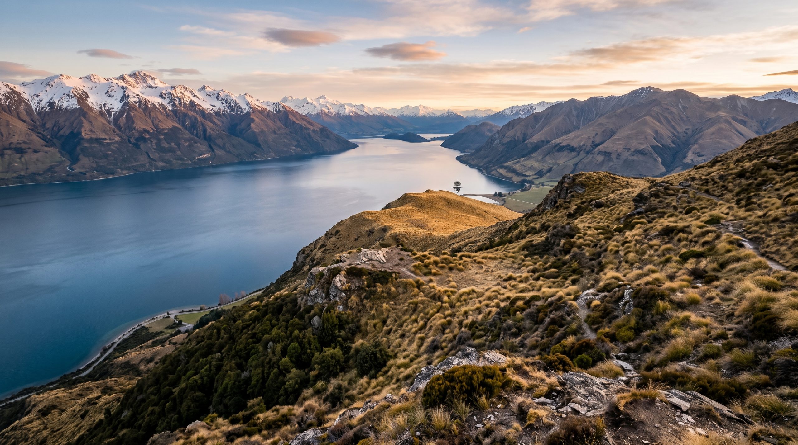
In late December the almanac gives Wānaka a sunset just after half past nine in the evening. The tree loses the sun long before that. The Roys Peak ridge rises to 1,578 metres a short way behind the southern shore, and through the summer half of the year the sun goes down behind that skyline while the air above the lake is still bright and open.
Almost nobody planning a ceremony here knows that, and it reorganises the whole day. The most photographed willow in New Zealand grew from a fence post at the southern end of Lake Wānaka, stands alone in the shallows a short way off the shore, and shows a different amount of trunk depending on how high the lake is sitting that month.
What follows is the access, the light, the permission and the honest state of that shoreline at six in the morning. Then the five places within half an hour of the tree where we would rather stand you for the vows themselves.
Can you get married at That Wānaka Tree?
Yes. The shore in front of the tree is council reserve, so a ceremony there falls under Queenstown Lakes District Council’s wedding and civil union guidelines, and a permit can be required for a ceremony held on public open space. You also need a New Zealand marriage licence, applied for at least three working days ahead.
The ridge that takes the sun away early
Stand on the gravel where everyone stands and you are facing roughly north-west, out across Roys Bay, with the tree in front of you and the far shore behind it. That orientation decides everything about when this place works.
In late June the sun comes up around twenty past eight, well to the north-east, and it comes up low and slantwise across the water rather than over your shoulder. It goes again a little after five in the afternoon, out to the north-west, straight over the lake and directly behind the tree. That is the silhouette everyone has seen. It is only available in the cooler half of the year.
In late December the sun is up before six, from the south-east, which puts it almost directly behind you. The trunk is lit rather than blacked out, the far ranges take the first warm light, and the water is usually at its calmest of the whole day. Then the afternoon plays out very differently from the almanac. The sun swings around to the south-west, into that Roys Peak mass, and the shoreline loses direct light long before the printed sunset time. You can be standing there at eight in the evening in flat shade with a glowing sky above you and nothing on the water.
The crossover sits at the equinoxes. Around late March and late September the sun sets due west, and from then until the following equinox it drops over the lake instead of behind the ridge. A March or April ceremony gets the last useful thing this location does: a sunset that stays on the water until it actually goes.
The twenty minutes when the shoreline is yours
Arriving early is not the answer here, because every person on that gravel has read the same advice. On a settled summer morning there are tripods in place before first light, and the run of people continues through the middle of the day, because the walk in from the parking on Mount Aspiring Road takes a few minutes on the flat and requires nothing of anyone.
The gap is real but it is short. It falls roughly half an hour to forty minutes after sunrise, once the sunrise group has packed up and driven into town for coffee and before the first walkers come out along the lakefront track. We plan for that window rather than for the sunrise itself, hold the ceremony somewhere quieter, and bring you to the tree for the part of the morning when the shoreline genuinely empties. In June and July, on a weekday, it can be empty for much longer than that.
Five places we would rather hold the ceremony, ordered by distance from the car
None of these is a compromise. Each one gives you the lake and the ranges without a stranger’s telephoto lens in the background, and all five are close enough that the tree still fits into the same morning.
| Place | From the car | Underfoot in wedding clothes | Best hour |
|---|---|---|---|
| That Wānaka Tree | A few minutes on the flat | Path, then loose shingle | Sunrise, or 40 minutes after it |
| Roys Bay shoreline | Five to ten minutes on the flat | Grass, then shingle | Sunrise and late afternoon |
| Glendhu Bay | Park and step out | Grass to the water | Afternoon and evening |
| Diamond Lake platform | Short steep climb, some steps | Dirt road, then bluff track | Late morning to afternoon |
| Rocky Mountain, 775 m | Steep circuit above the platform | Boots up, change at the top | Midday to mid-afternoon |
| Roys Peak, 1,578 m | Long climb from the road | Boots up, change on the ridge | Sunrise, late summer and autumn |
Roys Bay, a few minutes west along the shore
The reserve does not stop at the tree. Walk west along the lakefront and the crowd thins out within a few minutes, and you get the same water, the same skyline and a shoreline nobody is queuing for. Underfoot it is flat grass and then loose grey shingle at the water’s edge, which is kind to a long hem right up until the last two metres. This is the option when someone in the party cannot walk far, and it is far better than its reputation.
Glendhu Bay, on the same sealed road
Head west on the Wānaka to Mount Aspiring Road, past the Roys Peak car park at seven kilometres, and Glendhu Bay opens on your right well before the Diamond Lake car park at 18.5 kilometres. You can park and be standing on grass at the water in under a minute. The bay opens north across the water, which puts the tall ground behind you rather than in your background, and it is our standing answer when the lake is high in spring and the shingle in front of the tree is under water.
The platform above Diamond Lake
The Diamond Lake car park sits 18.5 kilometres west of town on a sealed road. From there an old dirt road runs in to Diamond Lake itself, and then a steep climb up the bluffs, part of it on steps, brings you out at a viewing platform above the small lake. It is the shortest real climb near Wānaka and the change in scale at the top is out of all proportion to the effort. In a dress this is a carry-and-change job. We take the clothes up in a pack, you climb in boots, and we build fifteen minutes into the timeline at the top for you to change and catch your breath.
Rocky Mountain, 775 metres
Keep going above the platform and the circuit climbs to the Rocky Mountain summit at 775 metres, with the whole southern arm of Lake Wānaka below you and Mount Aspiring / Tititea away to the north-west. Sections of the track are steep. This is the ceremony for couples who want to have earned the view and still be back down for a long lunch. Those bluffs face south and hold their shade, so we keep this climb for the warmer half of the year and time it for the middle of the day rather than the edges.
Roys Peak, and the six weeks it is shut for lambing
The car park is seven kilometres north-west of Wānaka and the track zigzags up a steep four-wheel-drive route before it opens into tussock. The summit is 1,578 metres. Two things shape the plan. The track is closed for lambing every year from 1 October to 10 November and reopens on the 11th, which takes a chunk out of the spring calendar. And the mountain holds snow through the cold months, so from about June we build these days on Rocky Mountain or Diamond Lake instead and keep the high ridge for the settled end of summer and autumn. The famous spur below the summit collects a line of people at sunrise. There is more room, and more quiet, a few minutes further up.
Who gives permission, and what sits on your side of the line
Three separate authorities matter here and they do not overlap. The lakefront at the tree, Roys Bay and the town reserves are Queenstown Lakes District Council land, managed under the Reserves Act 1977, and the council publishes wedding and civil union guidelines covering which sites can be booked, how often, and for how many people. The council is clear that a ceremony on public open space can require a permit and that receptions belong in a private venue.
Diamond Lake, Rocky Mountain and Roys Peak are public conservation land. The Department of Conservation runs commercial activity on that land through a concession, which is the operator’s responsibility rather than yours, and it is the reason we ask about your location shortlist early rather than a fortnight out.
Then the licence. A New Zealand marriage licence is applied for online through the Department of Internal Affairs, currently costs NZ$150 when you are marrying with a celebrant, must be applied for at least three working days before the ceremony, and stays valid for three months. You do not need to be a New Zealand citizen or resident. If the legal machinery is the part that worries you, our guide to planning an elopement walks through the order of operations, and the permit research and the site liaison for all of the above are ours to do. The fees themselves, along with the celebrant, sit with you. A full day with one photographer or one filmmaker starts at $4,900 and a day with both working together starts at $7,900, with the rest of the detail on our pricing page.
Two cameras on a strip of gravel
The shore at the tree is narrow. There is a band of shingle, then the path, then grass, and that is the whole stage, which is exactly why a photographer and a filmmaker who met that morning end up standing in each other’s frames. Ours do not, because they have worked the same ground before and split it by habit: one low and close on the shingle, one back on the grass on a longer lens. Wind is the other thing. It funnels down the bay from the north and it will eat spoken vows, so on an Expedition day the audio goes on before anyone speaks rather than after. You can see how the light and the water actually behave here in our published galleries and films.
Common questions
Does the lake ever get too high to stand near the tree?
The level moves with the season, and in a wet spring the shingle strip people stand on can be under water while the tree itself is fine. We check the level in the days before rather than assuming, and Glendhu Bay is the swap, on the same road, with grass instead of shingle.
Do we need a permit to hold the ceremony on the Wānaka lakefront?
Possibly, and it depends on the exact site and your numbers. The lakefront is Queenstown Lakes District Council reserve and the council’s wedding and civil union guidelines set out which locations can be booked and the capacity limits on each. We do that research and the liaison as part of planning your day.
Can we climb Roys Peak for a ceremony in late October?
No, the track is closed for lambing from 1 October until 10 November and reopens on the 11th. Rocky Mountain and Diamond Lake stay open through that period and sit on the same road, so an October date loses the summit but not the height.
Will we have the tree to ourselves at sunrise?
In summer, no. There will be other people on the gravel and some of them will have arrived before you. The reliable quiet comes about half an hour after sunrise, on a winter weekday, or a few minutes west along the same shore.
How far ahead do we need the New Zealand marriage licence?
At least three working days before the ceremony, and it stays valid for three months, so most couples apply a few weeks out. It currently costs NZ$150 when an approved celebrant is marrying you, and you can apply from overseas.
Where do we change out of boots on the Rocky Mountain climb?
At the top. There is no building up there, so we plan it properly: clothes and shoes carried in packs, a sheltered spot chosen off the summit track, and a quarter of an hour written into the timeline so nobody is rushing into a dress on a slope.
Building the morning around the light
A good Wānaka day usually runs like this. Up in the dark, ceremony somewhere quiet while the ranges take the first colour, the tree in the empty half hour after the crowd disperses, breakfast, then out along Mount Aspiring Road in the afternoon for the height and the evening light. If your instinct is the other way around, a single climb and a long slow day up high, tell us and we will build that instead. Our destination guides cover how the same thinking applies elsewhere in the South Island.
We keep the planning in one written thread, at whatever hour suits your time zone. Send us your dates and the shape of the day you have in mind, and we will come back within a day with the light times, the permission picture and an honest read on which of these six places fits what you actually want. Tell Us Your Story.