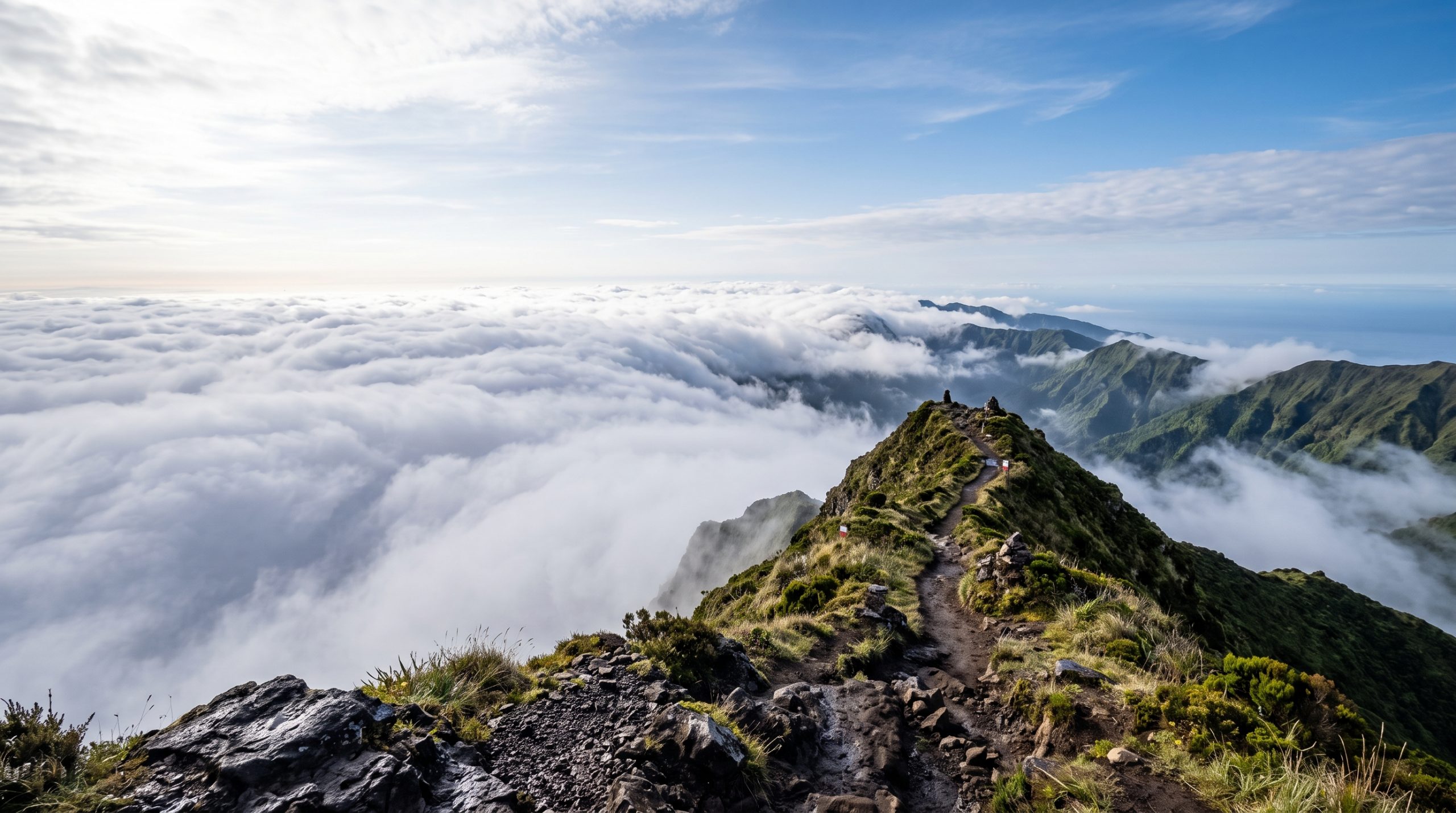
Before the light and before the walk, there is a form. Access to the Pico da Vara Nature Reserve is conditioned, and the Azores regional environment authority grants it through an online request. File it, carry it, and the highest ground on São Miguel is yours to stand on at 1,103 meters.
The second thing to know is that one route is open. The old link from Algarvia and the traverse over the Graminhais plateau are closed, so every authorized ascent now begins near the forest guard house at Atalhada, above the village of Santo António Nordestinho on the Nordeste coast.
The third is that nothing waits for you at the top. No shelter, no railing, just a concrete geodesic marker on a narrow crown of grass and heather, with the north coast of the island on one side and the south coast on the other. That emptiness is the reason to come up here.
The one route up, and the form that opens it
Yes, you can hold a ceremony on the summit of Pico da Vara. Access to the nature reserve is conditioned, so we file the authorization request with the regional environment authority and walk the single open route from Santo António Nordestinho: about seven kilometers there and back, 630 meters of climbing, three to four hours on foot.
From Ponta Delgada to the guard house at Atalhada
Ponta Delgada to this end of the island is roughly 53 kilometers and about an hour of driving, most of it on the EN1 as it works along the north coast through Ribeira Grande and the villages of Nordeste. Nothing about the drive is difficult. It is simply longer than couples expect when they look at the map, and it matters, because the last stretch of it happens in the dark on a ceremony morning.
From the villages, a gravel forest road climbs into the trees to informal parking on the mountain road at around 657 meters, beside the trail boards. It is gravel and it is steep in stretches, and it is a road you drive slowly rather than confidently. A small hire car gets up there. It gets up there better in the dry, and better still with someone in the passenger seat watching for logging traffic on the lower section.
The walk itself starts gently and dishonestly. The first kilometer is more forest road than trail, running under cryptomeria with cattle in the clearings, and it feels like a warm-up that never quite arrives. Then the path narrows, the plantation gives way to low grasses and heather, and the climb becomes steady rather than technical. There are saddles where you lose a little height and gain it back, a viewpoint over Santo António Nordestinho and Algarvia, and then the crown of the mountain in sight ahead of you.
The mud is the part nobody puts in a caption. This is the wettest, greenest corner of São Miguel, sitting on peat that holds water for days, and there are slick sections twenty meters long even in a week without rain. In wedding clothes, that changes everything and it changes nothing. We walk up in boots with the dress and the suit carried in dry bags, and we change on the ridge in the last shelter of the heather before the summit crown. A long train is the wrong garment for this mountain. A shorter hem, a dress you are content to see marked at the edge, and shoes you can actually stand up in on wet grass will give you a better hour at the top than anything chosen for the drive.
The cloud clock on Serra da Tronqueira
Pico da Vara makes its own weather, and it usually makes it late in the morning. The pattern locals and guides describe is consistent: a clear crown at first light, cloud gathering around the summit through the middle of the day, and a ridge that can be entirely white by early afternoon. That single tendency governs the whole plan. Everything about a day here is built backwards from the hour the top is most likely to be open.
The geography helps you once you are up there. The summit sees both coasts at once, which means the light has somewhere to be no matter which way it arrives. Sun comes in off the Atlantic from the east, low and directly along the ridge, and the vows can face whichever side is behaving. On the mornings when cloud sits below the ridge rather than on it, you get a floor of white with Furnas and the Lagoa do Fogo cone standing out of it, and the couple in the only clear air on the island.
The forest section, by contrast, stays dim long after the ridge is bright. That is useful. It means the walk up is not wasted time in flat light, and the first frames of the day come as you break out of the cryptomeria into open ground with the sun still low behind you.
Who else is on the ridge
Pico da Vara filters itself. Sete Cidades and Lagoa do Fogo take coach traffic; this takes people who filled in a form and then climbed 630 meters. Start at first light on a weekday and there is a real chance you have the crown to yourselves for the ceremony. Be straight with yourself about summer weekends, though. The summit is small enough that two hikers with sandwiches are a crowd, and in August you will meet some. If solitude is the thing you actually want, say so and we will aim the date at it.
What the summit gives a camera
There is no architecture up here and no obvious hero object beyond the geodesic marker, so the frames are made of ridge lines, cloud and scale. That suits the place. The strongest images from Pico da Vara tend to be wide, with the two of you small on the crown and the whole eastern end of the island stacked behind you in green terraces, and then very close, because the wind and the cold do something to faces that a studio never will. You can see how this kind of high, exposed ground reads in photographs and on film across our published stories and galleries before you commit to a day of walking for it.
The crown is a working space of a few paces, and that is the honest constraint on filming here. Two people cannot circle a couple on a summit this narrow without ending up in each other’s frames, so our photographer and filmmaker split along the crest instead, one working the line of the ridge while the other drops a few meters down the slope and shoots up. Wind is the other factor. It is rarely still at 1,103 meters, which is why vows get set on the lee side of the crown rather than the top of it when we are recording audio, and why the aerial work happens in the calm at the start of the morning rather than whenever it occurs to us.
Highlights from a day like this reach you within 5 days, and the full gallery or film within 3 weeks.
What the reserve asks, and what it does not
The reserve is 786 hectares on the Serra da Tronqueira, sitting on rock about four million years old, and it holds the largest surviving stand of native laurel forest on São Miguel. Inside it lives the priolo, the Azores bullfinch, a bird that exists nowhere else on earth and only in the municipalities of Nordeste and Povoação. The whole area is a Natura 2000 Special Protection Area and an Important Bird and Biodiversity Area. That status is the reason the access authorization exists, and it shapes ordinary courtesies: stay on the marked path, no petals and no confetti, carry everything back down, keep the noise to your own two voices.
Aerials are a separate permission. Flying over protected areas in the Azores runs on an authorization from the regional environment authority, requested through their online form, so we confirm that before we plan any part of the film around a drone rather than after.
The legal paperwork of a marriage, on the other hand, has nothing to do with the mountain. It is a civil registry process that happens off the ridge entirely, and we walk you through what your particular passports require as part of planning; the fundamentals are set out in our guide to planning an elopement. Permit research, filing and logistics are ours. Government, landowner and venue fees are yours, along with accommodation and any vendors. Team travel is included wherever in the world you take us, which for the Azores means we arrive rested and on island time rather than off a red-eye. The Adventure covers one full day with a dedicated photographer or filmmaker from $4,900, and the Expedition puts both on the mountain together from $7,900, with the rest set out on our pricing page.
If the summit is capped at seven in the morning
Then we do not spend the morning arguing with a cloud. The Graminhais plateau sits between 900 and 960 meters on the north rim of the old Povoação volcano, with boardwalk over peat bog and Azorean cedar, and it holds atmosphere in exactly the conditions that close the summit. Lower down, the laurel forest where the priolo actually feeds photographs beautifully in flat light and rain. The Priolo Environmental Centre at the Cancela do Cinzeiro forest park is a real building with a roof, which matters more than it sounds like it should at nine in the morning in Nordeste.
All of this sits inside the same two municipalities, so switching the plan is a short drive rather than a lost day, and the summit can move to the following morning if your dates allow it. That is what a weather alternative means in practice: a second and third location already researched, timed and permitted, chosen for how they behave when the mountain is not available. More destinations across the archipelago and beyond are collected in our destination guides.
Common questions
Do we need permission to walk up Pico da Vara?
Yes. Access to the Pico da Vara Nature Reserve is conditioned, and authorization comes from the Azores regional environment authority through an online request form. Only the Santo António Nordestinho approach is currently authorized. We file the request as part of planning and carry the confirmation on the day.
Can you drive to the top of Pico da Vara?
No. The gravel forest road ends at informal parking around 657 meters, near the guard house at Atalhada, and everything above that is on foot: about seven kilometers there and back with 630 meters of climb, three to four hours of walking plus your ceremony time on the summit.
Is there anywhere to change out of hiking boots?
Not a building, no. We change at the parking area before we start, or on the ridge in the shelter of the heather just below the crown, with clothes carried up in dry bags. There is no shade and no windbreak on the summit itself, so the changeover is quick and planned in advance.
How likely is it that the summit is clear when we get there?
Best at first light, and the odds fall through the morning as cloud builds around the peak. That is why we start early rather than sleeping in, and why we hold the Graminhais plateau and the lower laurel forest as alternatives that work well in exactly the weather that closes the top.
Can we fly a drone over the reserve for our film?
Only with authorization. Flights over protected areas in the Azores are approved case by case by the regional environment authority through its online request form, so we confirm the permission and the window first and build the aerial part of the film around what has actually been granted.
Can we legally marry on the summit itself?
The vows and the ceremony happen up there; the legal registration is a civil registry process that takes place off the mountain. Many couples we work with complete the legal side separately, at home or in town, and treat the summit as the ceremony that matters to them. We map out both timelines before you book anything.
Booking a morning on the Tronqueira ridge
We are eight people, photographers and filmmakers who plan the day together rather than meeting on the morning, and we are currently booking 2027, 2028 and 2029. For Pico da Vara, the useful things to tell us are your month, how you feel about a pre-dawn start, and whether the two of you on an empty ridge is the point or just a bonus. Every planning step stays in one written thread, so you can read, think and reply in your own time, and the first reply and brochure come back within 24 hours. Tell Us Your Story and we will tell you honestly which weeks on this mountain give you the morning you are picturing.