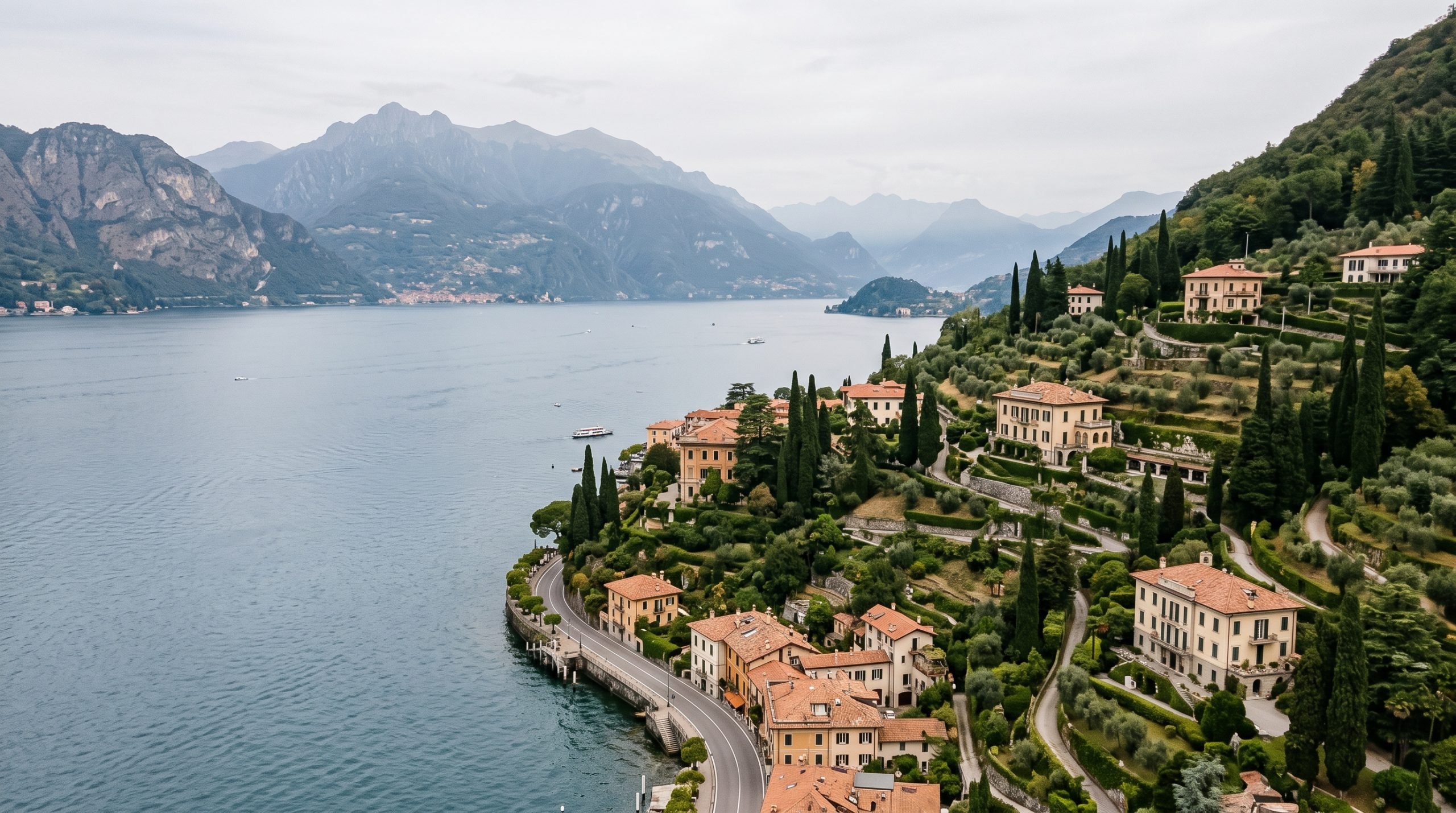
Lake Como is not one place, and that is the whole problem with the question. It is 146 square kilometres of water, 160 kilometres of shoreline and 46 kilometres from the head of the lake down to the tip of the Lecco branch, with mountains that start climbing more or less at the waterline. The legal answer to whether a drone can fly changes depending on which stretch of those 160 kilometres you are standing on.
So the useful version of this article is not a list of places where aerials are allowed. It is the method for finding out, the order the paperwork has to happen in, and the specific things that quietly go wrong three weeks before a wedding date. We fly here, we file here, and we have had the conversation with property offices on both shores.
Everything below is written for couples marrying on the lake in 2027. The framework itself is stable. Italy operates under EU Regulations 2019/947 and 2019/945, enforced nationally by ENAC, and those have been in force long enough that the transitional wrinkles are behind us. What moves from year to year is the tariff table, the property calendars and the zone map, and we say clearly below which is which.
Two permissions, not one
Every aerial frame on Lake Como needs two separate yeses. The airspace has to be open at that exact point, which the d-flight map run by ENAV decides, and the property owner has to agree in writing. Both take time to secure. Neither one substitutes for the other, and the map is checked per location, not per lake.
Where Lake Como drone planning gets technical
Honest rating: fiddly. Not fiddly in the sense of obscure, but fiddly in the sense of having four or five moving parts that all have to be current on the same morning. An operator registration, a pilot attestation, a liability policy, a zone check for the precise coordinates, and a written note from whoever owns the ground. None of those is difficult on its own. The failure mode is always that one of them has lapsed, or that the ground consent came through for a Thursday and the ceremony moved to a Wednesday.
For a couple arriving with a drone in a suitcase, doing this properly from scratch for one flight is more administration than the footage is worth, and the machine usually stays in the bag. For a team that is already registered, insured and certificated in the EASA system, it is a normal part of location planning. That is the practical reason aerials tend to come from the film side of a wedding rather than from a guest.
We are photographers and filmmakers, not lawyers. Rules change and circumstances differ, so confirm the detail with ENAC or with the property itself before you book flights.
The chain, in the order it has to happen
These steps are sequential for a reason. Each one is a prerequisite for the next, and skipping ahead is how people end up with a valid certificate and an invalid flight.
- Operator registration. The operator, not the aircraft, is what gets registered. EASA is explicit that a non-EU resident has to register with the national aviation authority of the first EU country they intend to operate in, and that the resulting drone operator registration number must be displayed on every drone the operator owns and loaded into the aircraft’s remote identification system. Once it exists, it is valid across the EASA states. In Italy that registration happens on the d-flight portal, run by ENAV in agreement with ENAC.
- Remote pilot competency. The Open A1/A3 attestation comes from an online course and a 40-question multiple-choice exam with a 75 per cent pass mark, and ENAC issues it with a validity of five years. The A2 certificate of competency sits on top of that and needs a supervised exam. ENAC does note that pilots of camera drones under 250 grams are not obliged to hold the pilot attestation, though the other requirements still stand.
- Third-party liability insurance. Italy goes further than the EU baseline here. Under Article 27 of ENAC’s Regolamento UAS-IT, liability cover applies to unmanned aircraft generally rather than only to the heavy end, with toys as the exception. A certificate in date is part of the file, not an optional extra.
- The geographical zone check, per location. ENAC’s own guidance for the Open category tells operators to verify permitted and prohibited zones on d-flight. The geo-awareness layer is free to registered users. This is the step that answers where you can fly, and it answers it for a point on the map, not for the lake as a whole.
- Written consent from the ground. Airspace clearance says the aircraft may be there. It says nothing about launching from a villa terrace, landing on a private jetty, or producing commercial footage of a private garden. That is the property’s call, it comes in writing, and on the historic estates it goes through an office rather than a person.
- A Specific category declaration, if the flight will not fit in Open. If the frame you want sits closer to uninvolved people than the Open subcategories allow, the route out is a declaration under a standard scenario, filed digitally on d-flight. ENAC charges a fixed fee for issuing the declaration, currently 114 euros, paid through ENAC’s online services portal, and the invoice number then has to be written into the declaration form itself.
- The Drone Operation Area on the day. d-flight lets a registered operator create and activate a Drone Operation Area so that other portal users can see, anonymously, that there is activity in that airspace. It is not obligatory. We do it anyway, because on a lake with as much low-level traffic as this one, being visible to other users costs nothing.
Which subcategory your aerial lives in
Across the whole Open category the ceiling is 120 metres and the aircraft stays in visual line of sight. Within that, the subcategory decides how close to people you may be, and it is the difference between an aerial that works at a ceremony and one that only works over empty water.
| Subcategory | What the rule turns on | What that means on this lake |
|---|---|---|
| A1 | The lightest aircraft, including sub-250 gram machines. Assemblies of people are out in every case. | The frame that lifts off a quiet shoreline and goes out over the water while the guests stay behind the pilot. |
| A2 | Class-marked aircraft under 4 kilograms, flown nearer to uninvolved people on the strength of a supervised certificate of competency. | The subcategory that makes a village lane in Varenna or a garden with visitors still in it a realistic proposition. |
| A3 | Everything else. At least 150 metres from residential, commercial, industrial and recreational areas, and nobody uninvolved anywhere in the flight zone. | Open water, high ground above the villages, and the hour before the first ferry when the shore is still asleep. |
The reason this matters more at Lake Como than at, say, a wide coastal site is that the flyable ground and the beautiful ground are often the same narrow strip. Lenno, Bellagio and the Tremezzina villages are built along a shelf a few hundred metres wide between water and mountain. There is not much room to put 150 metres between an aircraft and a residential area without ending up over the lake, which is frequently exactly where you want to be anyway.
Build the drone-permission calendar from the wedding date
Two timelines are worth holding in your head. The real minimum is short. If an operator is already registered, insured and certificated, and the location clears on the zone map, an Open category aerial over an unrestricted stretch of shore can be organised inside a week. That is the floor, and it is genuinely achievable.
The comfortable minimum is eight to twelve weeks, and it is set almost entirely by the ground rather than the air. Property offices on the lake work in seasons, answer in batches, and are at their slowest in the months when they are also running a full visiting calendar. We work to the comfortable minimum and we lock locations at the proposal stage rather than after the contract, because a location that clears the map is worth building the rest of the day around.
- Twelve months out. Locations chosen and checked against the zone map before anything else is booked. The map has an opinion about your shortlist and it is better to hear it early.
- Six months out. Written requests in to the estates and villas, with the date, the window, the aircraft and the intended use spelled out. Vague requests get vague answers.
- Three months out. If a Specific category declaration is needed, this is when the fee is paid and the declaration filed, so the invoice number is in hand well before anyone is packing.
- One month out. Registration subscription current, insurance certificate in date, pilot attestation nowhere near its five-year expiry. Boring, and the single most common thing to slip.
- The week of. Zone map re-checked for temporary restrictions, wind forecast read properly rather than glanced at, and the ceremony hour confirmed against the light.
- The morning itself. Drone Operation Area activated, guests briefed, launch and landing points walked before anyone is dressed.
The numbers below are useful for sequencing the trip, but they are not fixed forever. Re-check the current amount and deadline with the issuing office before you lock in flights or appointments for lake como wedding drone rules.
What catches people out on this lake
This is the section nobody publishes, because it only comes from having done it. None of these is dramatic. All of them are the kind of small thing that turns a planned aerial into a grounded one.
- Airspace yes, garden no. The most common misread of the whole system. A clear zone map is a statement about the sky. The villa gate is a separate negotiation, and it is the one that takes longer.
- The 120 metre ceiling moves. It is measured from the closest point of the surface below the aircraft. Lake Como sits at 198 metres above sea level and its walls rise steeply from there, so a launch from a high terrace and a run out over the water are two different numbers on the same flight. Pilots who fly flat coastlines get this wrong the first time.
- Property calendars, not just property permission. Villa del Balbianello, on the Lavedo promontory at Lenno, is an FAI property with a published visiting season and fixed weekday closures inside it. A garden with a full visiting calendar and a garden on a closed day are two different operating environments, and the answer you get depends on which one you asked about.
- Registration is per operator, not per aircraft. One number, displayed on every drone in the fleet and loaded into remote ID. Couples sometimes assume each machine needs its own file. It does not, but the number does have to physically be on the aircraft.
- The fee mechanics have their own paperwork. ENAC’s fixed charge for issuing a Specific category declaration is paid on ENAC’s online services portal, and the invoice number is then quoted inside the declaration. Pay it and forget to carry the number across, and the file is incomplete.
Guests, and who counts as involved
Wedding guests are the variable that most drone guidance ignores, because most drone guidance is written for surveyors. The rules distinguish between people who are part of the operation and people who are not, and the second group is the one that shapes where the aircraft can be. In practice that means guests are briefed before the aircraft leaves the ground, told where the flight line is, and asked to stay off it. That is a two minute conversation and it changes what is possible for the next twenty.
This is also the one place where working with a photographer and a filmmaker together makes a measurable difference rather than a marketing one. When the drone is up, the person flying it is flying it. If that is your only camera, the ceremony hour is being covered by an aircraft. With a dedicated photographer on the ground and a dedicated filmmaker on the controller, the aerial costs you nothing on the ground, and the ceremony hour can be placed where the light is best rather than where the flight plan is easiest.
Guest numbers change access, permits and timing rather than the fee, and drone footage is included in every experience where it is legal, safe and appropriate, as set out on our pricing page.
The version of the film with no aerials at all
Some of the best work we have made on this lake has no drone in it, and this is worth saying properly rather than as a consolation.
Lake Como gives you elevation for free. The shore road climbs, the villages stack up the hillside in terraces, and a camera on a stone staircase forty metres above the water is already doing most of what an aerial does, with better light and no permission required. The other trick the lake hands you is the boat. A wooden taxi boat is a moving camera platform that can hold at any distance from the shore you like, and a long lens from mid-water gives you the villa, the couple and the mountain compressed into one frame in a way a drone at 100 metres genuinely cannot. Isola Comacina, the only island on the lake, is best filmed from the water rather than above it for exactly this reason.
If the aerials fall through, or if the location you fall in love with turns out to be one where they are not on offer, the film does not lose its scale. It changes shape. You can see how both versions look in our published galleries and films, which is a more useful comparison than any description we could write here. Highlights reach you within 5 days and the full gallery or film within 3 weeks either way.
Tell us which locations you are drawn to and we will tell you honestly which ones support aerials, which ones are better filmed from the water, and which month gives you the emptiest shore for the hour you want. If aerials matter enormously to you, that answer should shape the location list rather than the other way round. Send Us a Message with the shortlist you have.
Which permissions we can plan around and which stay yours
Clear division, so nobody assumes.
Ours: the zone check for every location on your list, done before we recommend it. The registration, attestation and insurance that sit behind the aircraft. The written approach to estates and property offices, with the flight details set out in the form they expect. The timeline, built so the ceremony hour lands in the light rather than in the middle of the day. The alternative location fifteen minutes away, held in reserve, for the morning the wind comes down the valley harder than forecast. Permit research and logistics guidance are part of every experience we run, in every destination.
Yours: the permit and access fees themselves, where a property or authority charges one. Your celebrant, your accommodation, your vendors. Any unusual transport, which on this lake usually means a private boat. And the legal formalities of the marriage, which sit entirely outside this article. Our planning fundamentals cover the shape of the day, and the destination guides cover the ground.
What we do not do is file your paperwork or give legal advice. We plan around the constraints, we hold dates against the calendars that matter, and we tell you early when something on the list will not work.
Common questions
Do we need a drone permit ourselves, or does the film team handle it?
The obligations sit with the operator and the remote pilot, which is the film team. Registration, pilot attestation and insurance are ours. What can sit with you is the property side: if a venue or estate wants the request to come from the couple who booked it, that letter is easier coming from you, and we draft the technical detail that goes in it.
Can a drone fly at Villa del Balbianello?
Balbianello is an FAI property on the Lavedo promontory at Lenno, and any aerial work there is the estate’s decision, made in writing, separately from the airspace question. It also runs a published visiting season with fixed weekday closures, so the date you ask about changes the answer. We put that request in early and plan a water-level alternative in the same bay while it is pending.
Is a US drone certificate valid in Italy?
Italy runs on the EASA system, so a US certificate is not the document that counts here. EASA requires a non-EU resident to register as an operator with the aviation authority of the first EU country they operate in, and to hold the relevant Open category competency for the subcategory being flown. Once registered in one EASA state, that registration travels across the others.
How high can a drone go over Lake Como?
120 metres in the Open category, measured from the closest point of the surface below the aircraft rather than from the launch point. On a lake sitting at 198 metres of elevation with steep sides, that distinction is real. Flying out from a high terrace over the water changes your height above the surface as you go.
Can the drone fly over our guests during the ceremony?
Assemblies of people are out in the Open category, and how close the aircraft may come to anyone not involved in the operation depends on the subcategory and the aircraft class. In practice we brief guests so they know where the flight line is, keep it clear, and put the aerial either side of the vows rather than over the top of them.
Does a drone under 250 grams still need registering in Italy?
If it has a camera or records audio, yes, the operator registers. ENAC’s exemption from registration applies to sub-250 gram aircraft with no audio or video recording capability, and to drones classed as toys. ENAC does separately say the pilot attestation is not obliged for camera drones under 250 grams, though the remaining requirements still apply.
What happens to our film if the drone cannot fly that morning?
We shape the day so the film does not depend on it. Wind coming down the valley, a temporary restriction appearing on the map, or a property changing its mind the week before all have the same answer: the boat, the terraces and the higher shore road give you scale without an aircraft, and the delivery timeline does not change.
How far ahead should we decide we want aerials for a 2027 date?
Twelve months if you want the location list built around them, because that lets the zone check happen before you commit to a villa. Eight to twelve weeks is the working minimum for the ground consents. Under that, aerials become opportunistic rather than planned, and we will say so rather than promise them.
Planning a 2027 date on the lake
The good news about 2028 is that nothing structural is due to change. The EU framework is settled, ENAC’s guidance is published and stable, and the parts that move are the tariff table and the villa calendars, both of which we re-check as your date approaches rather than assuming. We are booking 2027, 2028 and 2029, and the shoulder months either side of high summer are when the shore is quietest and the map is least crowded.
Send us the villages you are looking at, the date you have in mind and whether aerials are a nice-to-have or the reason you chose the lake. We reply within 24 hours with an initial brochure, and everything after that runs in writing, at your pace, in your time zone. Start Your Story.